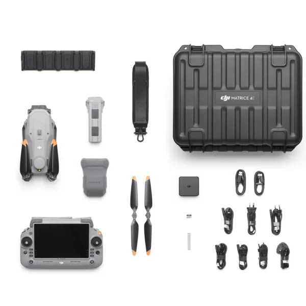
DJI Matrice 4E Enterprise Drone
₦9,000,000.00
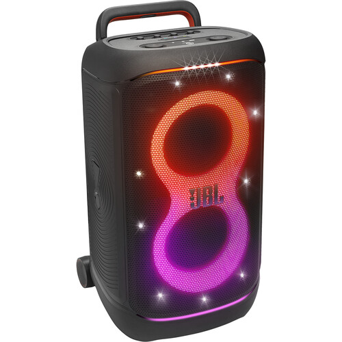
JBL PartyBox 520 400W Portable Party Speaker
₦950,000.00


No account yet?
Create an Account