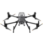
- Pick up from the Woodmart Store
To pick up today
Free
- Courier delivery
Our courier will deliver to the specified address
2-3 Days
Free
- DHL Courier delivery
DHL courier will deliver to the specified address
2-3 Days
Free
Hurry and get discounts on all Apple devices up to 20%
Sale_coupon_15
₦7,500,000.00
To pick up today
Free
Our courier will deliver to the specified address
2-3 Days
Free
DHL courier will deliver to the specified address
2-3 Days
Free
Payment Methods:
Meet the game-changer in precision agriculture: the DJI Mavic 3 Multispectral. Engineered for farmers and agronomists, this drone is a powerhouse of aerial surveying capabilities. It uniquely combines a high-resolution 20MP RGB camera with a state-of-the-art multispectral imaging system featuring a 4-band (Green, Red, Red Edge, Near-Infrared) 5MP camera. This dual-camera setup is designed to make the invisible visible, offering unprecedented insights into crop health and growth pattern.
The most valuable aerial data to collect in agriculture is invisible. However, with the all-new DJI Mavic 3 Multispectral you now have the ability to capture both RGB and multispectral data simultaneously, making the invisible visible. Scanning, measuring, and quantifying crop data has never been easier with the M3M. The M3M features a 4/3″ CMOS 20MP RGB camera as well as a 4-band (G,R,RE,NIR) 5MP multispectral camera. Flight times average 36-42 minutes with max flight endurance (without wind) is 43-minutes. This endurance will give you the ability to fly just under 500-acres in a single flight. Additionally, M3M is also compatible with an RTK module for increased position accuracy.
Multispectral + RGB imaging system
Newly upgraded imaging system with one 20MP RGB camera and four 5MP multispectral cameras (green, red, red edge, and near infrared0. Enables applications such as high-precision aerial surveying, crop growth monitoring, and natural resource surveys.
20MP Image Sensor
Mechanical Shutter Speed
High-speed burst when RGB camera is used
The built-in sunlight sensor captures solar irradiance and records it in an image file, allowing for light compensation of image data during 2D reconstruction. This results in more accurate NDVI results, as well as improved accuracy and consistency of data acquired over time.
RTK module
Mavic 3M with RTK module for centimeter-level positioning. Flight control, the camera, and the RTK module sync in microseconds to accurately capture the location of each camera’s imaging center. This enables Mavic 3M to do high-precision aerial surveying without using ground control points.
Ultra-long battery life, fast bursts
Flight Time
A single flight can complete mapping operations over an area of 200 hectares.
High-efficiency fast charging
Aircraft
The O3 transmission integrates two transmitting signals and four receiving signals to support 15km ultra-long transmission distances.
M3M features multiple wide-FOV vision sensors that accurately detect obstacles in all directions for omnidirectional obstacle avoidance. The terrain-follow aerial surveying can be easily performed in steep-slope landscapes.
M3MÂ allows terrain-follow aerial surveying of orchards, even on sloped landscapes. Together with DJI Terra or DJI SmartFarm Platform [6] to reconstruct high-resolution orchard maps, automatically identify the number of trees, distinguish trees from other obstacles or objects, and generate three-dimensional operation routes for agricultural drones, making operations safer and more efficient.
For rice fertilization, cotton growth regulation, and potato foliar fertilizer spraying, the Mavic 3M is used to obtain multi-spectral images of crops. DJI Terra or the DJI SmartFarm Platform can then generate NDVI and other vegetation indices maps, capturing differences in crop potential and generating prescription maps that allow agricultural drones to execute variable-rate application. This ultimately allows users to reduce costs, increase yield, and protect the environment.
The M3M can carry out automatic field scouting. The field scout images can be uploaded to the DJI SmartFarm Platform in real time through a 4G network. It can find abnormalities, such as emergence deficiencies, weed pressure, and crop lodging in a timely manner. It can also conduct intelligent analyses, such as cotton seedling identification and rice production testing, using AI identification for real-time sharing of crop growth information, guidance of agronomic activities, and easy management of 70 hectares of farmland by one person.
The Mavic 3M can also be used in environment and natural resource surveys, such as water enrichment monitoring, forest distribution surveys, urban green area surveys, and more.
In stock
In stock
No account yet?
Create an Account
Reviews
Clear filtersThere are no reviews yet.